Monthly Archives: August 2016

Mankinholes

I had decided to base myself in the village of Mankinholes, near Todmorden, for the weekend. Mankinholes lies below the Napoleonic monument of Stoodley Pike, which sits on the Pennine Way and is a great starting point for walks over the Pennine moors. Walking in warm sunshine from Todmorden railway station (a distance of only 2.5 miles along the canal and across fields) with breakfast, dinner and tea supplies for the weekend I decided to walk the more direct route so that supplies could quickly be dropped off at the hostel, and I could set off on an evening walk.

13710659_10100274862806762_8936804417525082893_o

Looking towards Todmorden

13667735_10100274861284812_1562272114731419358_o

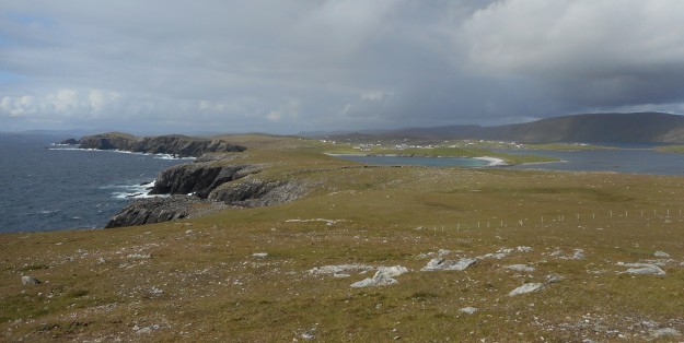
Stoodley Pike from the Pennine Bridleway near Mankinholes

Heading onto the moors in the early evening was the perfect way to relax after a day at work, and to visit Stoodley Pike without the usual crowds of the weekend. Stoodley Pike is a very popular local walk! I’ve approached the Pike from the Mankinholes (western) side, Hebden Bridge (eastern) side, and from Cragg Vale (south-eastern) side before and the approach from the west is far more enjoyable thanks to the views of Stoodley Pike along the moorland edge for around a kilometre or so. Approaching in any other direction just means that you don’t see it until you’re virtually there.

13668920_10100274861229922_7071303704357747470_o

Stoodley Pike on Friday evening

Having walked to Stoodley Pike on the Friday evening I felt I could now explore the moors without feeling like I’d ‘missed out’! Setting off on the Saturday in baking heat at only 8am, I plodded up onto the moors and instead of turning left towards the Pike, I turned right in the direction of the Pennine Way and Blackstone Edge. A stone seat at SD 966 228 dedicated to “our dad Cyril Webster who died 1992 ‘still walking the hills’” complete with backrest which provided some shade was very much appreciated. Whilst making the most of this unexpected treat I watched as two swallows swooped low in front of me and then a buzzard circled higher and higher in the cloudless sky.

Continuing on the Pennine Way to around SD 965 220, a path heads from here towards Withens Clough reservoir – I promptly left this to head up to the Holder Stones, Little Holder Stones and over the pathless moor to White Holme reservoir.

The Pennine Way can be found not far from here – after some very tedious walking along tracks and past pylons and turbines –

and followed until almost back in Mankinholes.

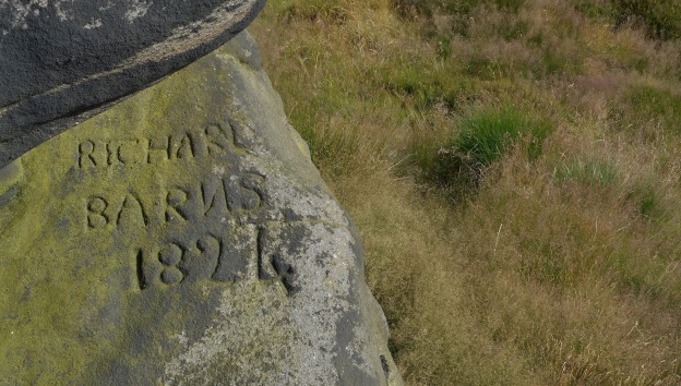
Before leaving the moors I decided to take a detour over Coldstones Hill and, finding a perfectly-shaped boulder for the purpose, spent almost an hour watching hang gliders and walkers making the most of the summer weather.

13735599_10100274862766842_6928678099549479871_o

Good spot for a rest, no?

Shetland: scratching the surface

There is so much of Shetland to explore, it feels as though it would be possible to visit the islands every year for the rest of my life and never grow tired of walking here. Visiting in June this year, we explored areas new to us which I could happily revisit time and time again.

A couple of areas which boast impressive views of popular hotspots include the peninsulas of the Ness of Burgi and No Ness. The walk out to the Iron Age fort of Ness of Burgi, on a narrow promontory just west of Sumburgh Head, has great views across the sea to cliffs which teem with puffins, guillemots, razorbills, kittiwakes and fulmars. An interesting stretch over jagged rocks to reach the peninsula is marked with posts and a metal chain, although in anything other than very strong winds these are largely unnecessary. Having walked around Sumburgh Head that morning I enjoyed seeing the cliffs from a lower angle, and the complete lack of visitors was a very welcome contrast to the coach parties at Sumburgh Head (although these are easily lost away from the lighthouse).

The Ness of Burgi from Sumburgh Head

The view from No Ness across to Mousa, an island RSPB reserve, can be reached by climbing a small hill which overlooks Mousa Sound. There are even the remains of a broch here, from which you can look across the Sound to the Mousa broch, the best-preserved in Scotland and which still has an intact staircase leading up to the top (and from which you can look back at No Ness).

2.Mousa from mainland

Mousa from No Ness


There are plenty of off-islands to explore around Shetland, and the trip out to Noss was one of the highlights of our visit. It’s possible to walk right round the island in a day – although the drama of the cliffs and the wealth of wildlife to see meant that even after getting one of the first boats across, we just managed to return in time for the last!

4.1Noss

The cliffs of Noss

IMG_0545

View towards Bressay and Shetland mainland from Noss

A much shorter walk, although no less exciting for that, is around the Kettla Ness on the island of West Burra which is connected to the mainland by a bridge not far from Scalloway. The white sandy beaches near Duncansclett, which seem popular with seals, are soon replaced by impressive cliffs, and perfect inland territory for exploring – so long as you don’t upset the (very defensive) breeding birds, of which there are plenty! Walk along the eastern shore on a rising tide and you may also have some amazing views of otters.

DSCN1196

Our best view of an otter was near Walls, on the western side of mainland. We’d walked up Sandness Hill and along the coast and, although we were above some pretty steep cliffs, an otter ran in front of us for longer than we’d have expected – possibly because a dead sheep masked our smell! – before clambering down to the shoreline.

IMG_0614

View from Sandness Hill, Westside

Somewhere we really wanted to visit was Fethaland, an area which includes the most northerly point in mainland Shetland. The scenery is different again from Westside, Noss and so on and the cliffs are incredibly dramatic. Walking from Isbister, we followed the coastline anticlockwise to the (very windy!) Point of Fethaland, again exploring every headland and promontory it was possible to walk out to and never being disappointed. It’s possible to continue back to Isbister by continuing anticlockwise along the coast, but having taken so long to explore just one half of this coastline we headed back along the inland track.

We still haven’t managed to reach everywhere on our ‘must see’ list after four weeks in the islands – Ronas Hill and the islands of  Foula and Papa Stour have as yet escaped. And I’m sure that when we next visit, hopefully taking in these places whilst we’re around, we’ll get to hear about new places to add to our ‘must see’ list!