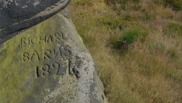
A Geltsdale Horseshoe

Distance: 19.1km / 11.9 miles
Total ascent: 649m / 2131ft

Maps: OS Explorer 315 (Carlisle), OS Landranger 86 (Haltwhistle & Brampton)

Link to route in OS Maps: https://www.ordnancesurvey.co.uk/osmaps/route/6930599/Cardunnth-Pike-Talkin-Fell

The North Pennines have their occasional honeypots, but Geltsdale isn’t one of them. The RSPB reserve is known for being one of the few places in England to see breeding hen harriers, despite pressure from illegal persecution here. Apart from a few weekend strollers between Gairs (NY 58231 55656) and the river Gelt, it’s quiet country.

Look out for red squirrels, particularly around Jockey Shield.

A brief note on the photos: not all of these were taken on the same day or even at the same time of year, mainly because I didn’t intend to publish them. Photos for the section before Gairs were taken in spring, and those after in autumn. Think of them as progressing from one season to another, via summer.

Parking available at Jockey Shield, NY 55791 55534. An infrequent bus (680) serves Castle Carrock from Carlisle and Alston.

Be aware that:

  • the route as far as NY 56123 53004 is largely pathless, stileless and gateless, and the ground can be rough underfoot. But it is nice.
  • the diversion from the path over Cumrew Fell to Cardunneth Pike crosses open access land and dogs are not allowed here – only on Public Rights of Way (the Croglin estate is a grouse moor).

Route description:

From Jockey Shield, walk back along the road towards Castle Carrock, with views towards the Border on your right. Turn left through a wooden gate, which is opposite a metal gate on your right. It’s also the first gate on your left.


Aim slightly right on the footpath, and aim for the disused quarries. Skirt these to the left hand-side and head uphill towards the wall which runs NE-SW. Climb over where it is easiest.


Turn right, and keep this wall on your right until you reach the wall corner. Turn left here, and follow the wall until the ground begins to descend – you should be able to see a path on the far side of the dip; aim for this through heather and rocks. The path skirts the next slope and allows an easier, if not easy, route to the wall at around NY 55698 54407. The path does note take you right to the wall, but will take you most of the way – bear right when you are almost there and, again, climb over the wall where it is easiest.


Head straight uphill, aiming for the cairn at Hespeck Raise (NY 55947 53784). This involves another climb over a stone wall, but you can then follow this wall, keeping it on your left, until you reach a gate at NY 56123 53004. Go through this gate.
Follow the track to the trig point at NY 56314 52508.
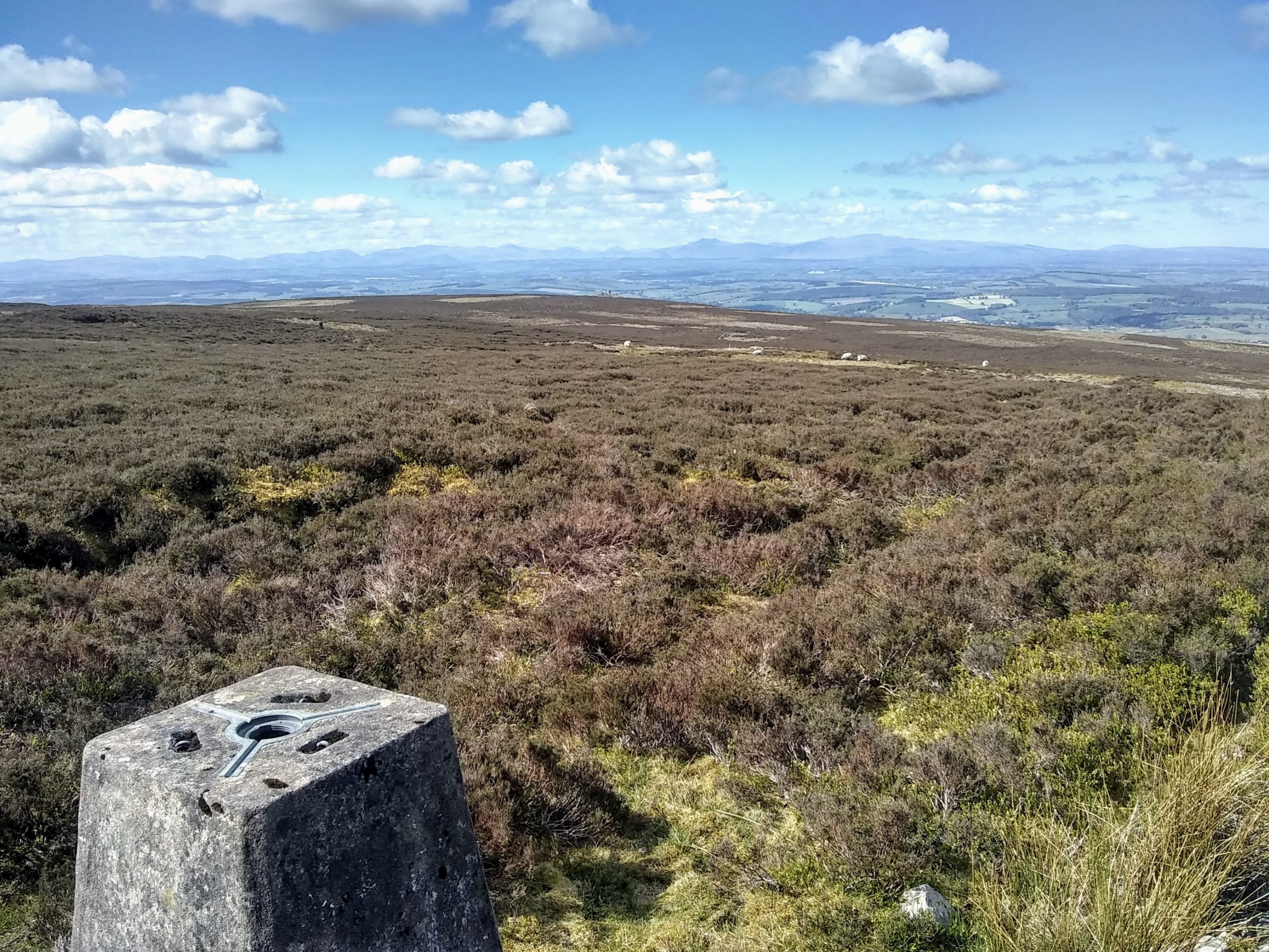
Cumrew Fell trig point

Cumrew Fell trig point, looking West


Turn right and follow the wall downhill slightly, then aim for the impressive structure of Cardunneth Pike, at NY 55874 52064. Continue along the edge of the moor until you reach another wall, and follow this back to the path at around NY 56433 51973. Cardunneth Pike is thought to be a Bronze Age burial site, but this hasn’t been confirmed.

Cardunneth Pike. Below: the view from the Pike


Follow the path along the top of Cumrew Fell. As it descends, a turning off to the right at NY 5690 5086 should be ignored. Pass grouse butts and eventually a shooting box.

Descending Cumrew Fell


On reaching the bottom, turn left. Follow the path towards Elter Beck and cross the bridge at NY 5789 5155.

Elter Beck


Cross the bridge and follow the path through a gate. Continue on this path, passing underneath Windy Bank. Ignore a left turn as the beck comes into sight at NY 5823 5309, and cross another bridge at NY 5855 5328.


Continue along the path, keeping left at NY 5880 5340 to pass underneath Tarnmonath Fell.


Turn off, left, at NY 5839 5548 to Gairs. Continue past Gairs and cross How Gill. Continue along the path until NY 5787 5530, where you can turn right to ascend Simmerson Hill (you can avoid Talkin Fell and Simmerson Hill by continuing along the track, which takes you to the River Gelt and the bridleway underneath Jockey Shield).

Looking up Geltsdale from the lower track (for those who bypass Simmerson Hill and Talkin Fell)


To climb Simmerson Hill, follow the faint path almost straight up. This turns left near the top to follow a delightful path along the edge. A diversion to the summit can be made, but the path does not head to the very top.

On Simmerson Hill


The path drops down to a sometimes wet hollow at NY 5741 5623. The path here can often be difficult to find in the wet ground, but aim to keep to the left of the fence, at the top of which is a stile.


Cross over the stile and follow the now clear path heading roughly uphill and leftwards. Another stile in the wall to your left takes you to the top of Talkin Fell, with wonderful extensive views.

Talkin Fell


Turn back and return over the stile, and along the path to the stile at NY 5714 5622.
Keep the wall to your right and head downhill. You will soon reach the track at 5719 5593.


Turn right and follow this track, turning left into a small woodland at NY 5587 5612
Descend through the trees and emerge through a gate at Low Hynam. Cross the bridge over the River Gelt.


Follow the tarmacked bridleway uphill to Jockey Shield.

A New Friend

Ascent: 563m
Distance: 13km
Maps: OS 1:50,000 Landranger sheet 90 (Penrith & Keswick); OS 1:25,000 Explorer sheet (English Lakes North Eastern area); Harvey 1:25,000 Superwalker, Lake District North

Situated in the far north-east of the ‘back o Skidda’, the Caldbeck fells are a haven for those who crave peace and quiet. On the first clear day in what felt like weeks, when more shapely fells would be understandably popular, I stayed north of the main attractions. The field paths leading out from Hesket Newmarket were muddy to say the least, but I reminded myself of the summer when, in the same fields, I was surrounded by wildflowers. Today the sky was blue and the bright sun was making the fells a wonderful yellow. It was 2°C in the sun and I knew I would have to keep moving to stay warm.

I first climbed High Pike only 18 months ago, but since then visiting has become a regular habit, aided by there being several ways to ascend and descend. I was looking forward to the solitude of this route, which only uses the busier (for the ‘back of Skidda’) paths for a very short way.

On reaching the Open Access land, distant views to the Pennines open up behind and remains of the area’s mining industry appear ahead. High Pike was mined from the sixteenth century until as recently as the 1960s, for copper, lead and later barytes. I followed How Beck and promised myself that I would read up about the industry here, having made the same promise countless times before.

I climbed through the old quarry and alongside what appeared to be a ‘hush’, used to expose mineral veins for mining. A pathless tramp across the moor soon brought me to a wide path. The sun disappeared at this point and, of course, only reappeared after leaving the summit.

The summit cairn was once a shepherd’s cottage, part of which has also been used to build a wind shelter nearby. From here, the extensive view includes Criffel to the north, with views towards Carrock Fell, Bowscale and other ‘back o Skidda’ fells to the south. I often pause between High Pike and Carrock Fell, around Hare Stones, to soak in the view of Bowscale Tarn.

Picking up Red Gate to descend alongside Carrock Beck, my questions around where all the previous weeks’ rain had gone were answered. Crossing the stream to pick up the riverside path and track was an exercise in creativity, and the track was often under a foot of water. It felt as though this part of the fell hadn’t seen the sun all day, and by early afternoon it was already setting.

I crossed the common and squelched across the various streams which had developed past White Well and down towards Hesket Newmarket, feeling the grip of winter and vouching to bring more layers next time.

View the full route at https://osmaps.ordnancesurvey.co.uk/route/6912002/High-Pike-from-Hesket-Newmarket

Enjoying Nature during Covid-19

The focus of my last post felt very much like the negative side of accessing nature this year (2020), so I wanted to describe some of the nice things which I also experienced.

Suburbia can be scenically… uninspiring. Weeks of suburbia did not change my mind about this. But something which I could do to add some interest to my lockdown walks was to take my binoculars (and sometimes my camera), and to notice the wildlife. Birds were gearing up for breeding and introducing their young ones to the world, and whilst I wasn’t going up hills I could afford to carry some extra weight in a pair of binoculars and a notebook. And when I took my binoculars and notebook, and didn’t encounter illegally blocked footpaths, I was never bored.

The reduced traffic levels were a godsend for watching wildlife. I could hear the birds! Sadly traffic levels are almost back to normal here, and one of my lockdown routes is now loud and unpleasant once again. But during lockdown, I would regularly see a whitethroat and I once saw a blackcap alongside a newly empty and quiet road, and it was one of the most enjoyable things I had experienced in lockdown. I am now very conscious of driving as little as possible (rather difficult at the moment as the Lake District and Hadrian’s Wall are too busy for me right now), and am trying to reduce the amount I use the car, as I loved walking alongside empty roads – and it must have been a relief for wildlife! The hedges were full of birdsong and I saw some birds which I hadn’t seen for years or which I didn’t expect to see so close to town. I started ‘visiting’ a heron which I regularly saw at the end of our street, which sat by an artificial pond in some waste ground, and checking in on the whitethroat – maybe this was my way of of socialising in lockdown.

M6

An empty M6!

A tiny patch of woodland, which takes all of two minutes to walk through, is now a favourite spot to visit when I don’t have much time to spare. I spent a lot of time here during lockdown and, although I haven’t seen any rare or surprising species here, even now there is very little noise from the road here and there are enough nooks and crannies to explore that, if you slow down and linger a little, you can lose yourself. It has been a surprisingly good spot for watching butterflies, as has a grassed lane behind our estate which we simply refer to as ‘dog shit lane’ because of… you can guess. But it has surprised me every time with the birds, butterflies or flowers I’ve seen here.

Since 2012 I have been very casually submitting records of the bird and mammals I see to the British Trust for Ornithology (BTO)’s BirdTrack project, which collects sightings submitted by the public to monitor populations of various species. I began this during my very first John Muir Award in the Forest of Dean, Gloucestershire. Now that I was heading out with binoculars every day, this research became a real motivator for me to improve my ID skills and learn more about what I was seeing. This has been equally true for butterflies – just before lockdown I had read Patrick Barkham’s ‘A Butterfly Year’ and, using the Butterfly Conservation Cumbria branch’s amazing website I had planned when and where to try and find some of the beautiful butterflies which can be seen around the county. During lockdown, I started to take photographs of some of the butterflies which I couldn’t identify there and then, and looked them up when I got home. I now submit records of the butterflies I have seen on my walks and love seeing what others have spotted around Cumbria.

Taking out a camera also meant that I could photograph the flowers which I was unfamiliar with, or which I didn’t know the names of. I couldn’t name most of the flowers I saw at first, but with a combination of ID books, Google and friends’ help I now have a pretty respectable knowledge of some British flowers! Seeing the transition of the seasons in one area, from noticing the first primroses to seeing the verges full of poppies, vetch, oxeye daisy and more, is something I really enjoyed. I really hope I take this up again next year (or do some flowers still linger into autumn? I don’t even know).

I also enjoyed seeing more of the wildlife in our garden. Since working from home we have had the leisure time to fill the bird feeders and water dishes every day, and I think the birds have appreciated it. I started contributing to the BTO’s Garden BirdWatch scheme, which collects garden wildlife sightings from the public to monitor how different species are faring across the UK.  I’m still doing this and intend to continue. Walking locally also meant that we had more time to sit and watch the garden and its visitors, and tweak things here and there to help what wildlife we saw or wanted to attract. When I saw my first hedgehog poo in the garden I told anyone who would listen!

In May we were suddenly allowed to jump in the car for exercise, and when I heard my first skylark and curlew since March, I felt so happy to be on the moors again that I started to reflect on how integral wildlife is to our sense of place. Imagine being on a moor and just hearing – silence. I knew that I had missed hearing curlew and skylark but I didn’t realise just how much until that first walk just a 15-minute drive away, when the first thing I wanted to do was go to the moors. I was reminded of the story of John Muir deciding to spend his life in the outdoors after being unable to see for months, due to an accident, and I use this story to remind me of what is important in my own life.

Thankfully we are still working from home for the moment and I can watch the passing of the seasons in my local patch. I love heading out straight after breakfast to visit my more local lockdown patches and see what flowers are blooming, what’s dying back and what I still can’t put a name to. I’m also incredibly grateful that, although I don’t (yet) live more rurally, I do have it pretty good.

Staying Local

Well a LOT has happened since I went slipping around the Solway at the beginning of March.

I haven’t posted anything since March as it has felt like, unless I was loving the rediscovery of what was on my doorstep, I would only be adding to the spades of negativity online. I live in suburbia, so closer to the countryside than a city centre, but the surrounding countryside is flat, often wet, with little to hold my interest unless I am armed with binoculars and a pocket guidebook of some sort. I tried, I really tried, to enjoy walks from the house – and for a short while I was fine with it. A huge barrier to enjoying these walks was the physical, illegal barriers put up by local farmers:

It also became clear that footpaths in the immediate area must be rarely used, given the state of some of the stiles and gates:

On one occasion we jumped a fence (as the stile was no longer usable) to find that a new construction site had closed both a road and a pavement, along with access to our next footpath. No construction was happening – sites weren’t able to continue work yet – but the fencing had remained. To avoid a roughly six-mile extension to a six-hour walk, I squeezed myself under the fencing and passed the perfectly safe site before squeezing myself under some more fencing to get out of the same perfectly safe site. Fencing not required.

Blocked or broken down stiles and gates were duly reported, but until they were sorted this was not going to be easy.

Despite this, I am very grateful that I do not know anyone who has had C-19, I have been able to work from home throughout, and I have a private garden to enjoy. I have had it relatively easy.

Once people in England were allowed to travel for exercise, everywhere was suddenly busy and – although it was amazing to be able to get to the hills and to usable footpaths again – it all felt (and still feels) like hard work. Not as relaxing as it used to be.

I am genuinely pleased that so many of us are able to enjoy the countryside, especially as I found the footpaths near our home so difficult or unpleasant to use and experienced active hostility from some landowners who felt entitled to prevent anyone from using what they saw as ‘their’ footpaths. I was also aware that others had experienced lockdown in more built-up areas than suburbia, and I know how I would feel if that had been me. I just live in a crowded country, and we have all been realising how important nature is for our wellbeing.

Areas I had previously visited for some peace and quiet were now the same places that others wanted to find some enjoyment in, so I tried visiting the more dramatic and popular areas in case everyone was elsewhere seeking out ‘quiet places’ – but nowhere was peaceful at the moment. I have had a few lovely days since May, including around Hadrian’s Wall and the Lake District, but it is harder to find peaceful spots, especially since overnight stays were made possible again. I have spent a lot of time in Galloway, despite wanting to cut my travel after finding it rather pleasant leaving the car at home in March and April. Walking country closer to home is just too busy; there are quiet hills, but they are few and far between and I don’t know how many times I can walk over Cumrew Fell. Lovely as it is.

IMG_20200514_103145275IMG_20200514_111205266

I am very much aware of the negative tone to this post, but I think it’s important to be honest about how I have found staying local when it felt like everyone around me was saying how much they were enjoying getting to know their local patch (was everyone enjoying it quite as much as they said?). Positivity returns soon, honestly.

Slipping around the Solway

The forecast said that it would be raining heavily until midday. Storm Chiara had passed through a few days before and I was happy to stay dry, at least above my feet, and head somewhere local once the downpour had finished. From Carlisle, the Solway is almost always a good option.

I have wanted to explore the area around Rockcliffe Marsh for a long time – the saltmarsh is important for waders and winter wildfowl, like most of the Solway, but this is a part of the Solway which I had not yet explored. I parked at Cargo, a village not far south of Rockcliffe, and planned to walk along the river towards the coast and back.

I did not anticipate the amount of water underfoot. Great for geese and anything which feeds on tiny creatures in the mud, though. On the way back, the water came above the top of my wellies and I made some interesting noises as I squelched back into the village.

IMG_20200213_131902063

In fact, the water had been so high that the path towards Rockcliffe disappeared into the river, so I decided to walk back upstream, west and south and finally along another lane back into the village.

Walking down the lane between the village and the river at the start of the walk, long-tailed tits, robins and wrens twittered in the hedge and a grumpy-looking heron stared at me from a neighbouring field.

The riverbank was covered with dead vegetation which had presumably washed up with the floods, along with the piles of litter. I managed to bring back two full carrier bags but could easily have picked another ten bags if I had brought enough with me. The snowdrops looked to have been through a tough time.

IMG_0892

Whilst walking downstream towards Rockcliffe and the coast, hundreds of pink-footed geese were alternately feeding and relocating across, behind and ahead of me, with their characteristic train-like volume and sounding genuinely surprised that I would continue walking in the same direction down the same enclosed lane.

IMG_0889IMG_0897

Curlews and oystercatchers were also flying overhead, but I don’t think it’s worthwhile uploading these photos of tiny specks, which could be anything, in the middle of a vast sky.

After turning back on the flooded riverside path, and heading upstream west and south, a pair of goldeneye appeared.

They seemed very nervous and flew off whenever I came remotely near to them, but they were absolutely beautiful to see even from a distance. A pair of goosanders also appeared but seemed to want to stay at a safe distance. I must look very intimidating.

After a while the sun came out and it was sheltered and warm, and I found a lovely spot to sit and watch the river rush past like the chocolate river in Willy Wonka & the Chocolate Factory. I even made a friend:

IMG_0933

A morning in the mist

IMG_20200123_120956366_HDR

The clouds were down almost to the valley floor, and the ground was sodden. Thankfully there is a section of the Cumbria Way to the north of Skiddaw which gives nice easy walking for days like these.

A track climbs gradually from opposite Peter House Farm near Bassenthwaite, towards Whitewater Dash falls, which despite the enormous amounts of water they were plummeting into Dash Beck I didn’t see until I was almost above them – although they were audible for a long way beforehand. I could see slightly further than my own body.

Whitewater Dash

Whitewater Dash

After a while I realised that I was listening a lot more than I was looking around; the mist was all you could see, apart from the occasional bird which would come crashing out of the mist looking both startled and, sometimes, curious about the strange animal which stood watching them. I heard the occasional wren and grouse, and once a raven, but generally I heard water rushing somewhere surprisingly fast€ for what seemed like a day made for taking your time.

In the absolute quiet past the waterfall I became excited at seeing one, then two, caterpillars of the fox moth, that seemed to prove that life was here, even in January. I started to reminisce about warmer days, as I reached Skiddaw House in soggy clothes, hat and gloves.

IMG_20200123_121434541

It seemed as though the only feature was water, in the air and below my feet. In supplication to the water, on bended knee I held the camera aloft in repeated proposals, hoping for a moody photo which would convince me that winter is just as enjoyable as the other seasons. Seasons when you aren’t wrestling with cold and water quite so much.

I had turned back round at Skiddaw House. Almost back at the road, the mist suddenly lifted, a little, and revealed the valley below the Cumbria Way.

IMG_20200123_141208710

Looking down towards the top of Whitewater Dash and Dash Beck, facing west

Passing farmland lower down, a flock of starlings was sharing a couple of fields with some sheep and, after rising and landing a couple of times, they obviously decided that the sheep had the best spot – and promptly dive bombed the helpless flock who scattered as fast as I have seen sheep move. It wasn’t worthy of calling David Attenborough about but it was enough to bring a smile to my face, which seemed pretty good for a damp January day.

A week on Arran

Despite having visited Arran only once – as a day trip – I already knew that Arran was an incredible place. So with a bank holiday weekend and a few days of leave left to claim, I headed for Lochranza and started planning the next few days.

The weather was amazing. I didn’t trust it. So while the sun shone, I went straight to Goatfell, the highest hill on the island. Stepping off the bus at Corrie I had no idea how many horse flies and midges I was to encounter on the (very sheltered and, for me, very sweaty!) way. Thankfully they seemed to lose interest after around 2700ft and left me to enjoy the last pull up to the summit.

On day three I was joined by my husband and brother-in-law, who despite many trips to Arran had not yet made it to Holy Isle. Reached by boat from Lamlash, on the southern half of the island, Holy Isle hosts the hill of Mullach Mor which provides excellent views back to Arran.

A much quieter area (though no less interesting) lies north west of the main Goatfell / Cioch an h-Oighe / Caisteal Abhail range. Climbing Beinn Bharrain from Pirnmill, continuing to Beinn Bhreac and returning via Coire Fhionn Lochan, the scenery was fantastic and offered wonderful views over to the main range of hills to the south east.

image

Watching the mist roll over Beinn Bharrain

image

The (deserted) ridge ahead – photo by Neil Collins

Lochranza was a perfect base – deer visited the loch in the evenings and an otter visited in the mornings. So long as you could ignore the midges you could have some great wildlife encounters here.

Staying in the hostel I met a number of people who returned to Arran time and again to explore its hills and coastline – clearly six days is not enough!

Mankinholes

I had decided to base myself in the village of Mankinholes, near Todmorden, for the weekend. Mankinholes lies below the Napoleonic monument of Stoodley Pike, which sits on the Pennine Way and is a great starting point for walks over the Pennine moors. Walking in warm sunshine from Todmorden railway station (a distance of only 2.5 miles along the canal and across fields) with breakfast, dinner and tea supplies for the weekend I decided to walk the more direct route so that supplies could quickly be dropped off at the hostel, and I could set off on an evening walk.

13710659_10100274862806762_8936804417525082893_o

Looking towards Todmorden

13667735_10100274861284812_1562272114731419358_o

Stoodley Pike from the Pennine Bridleway near Mankinholes

Heading onto the moors in the early evening was the perfect way to relax after a day at work, and to visit Stoodley Pike without the usual crowds of the weekend. Stoodley Pike is a very popular local walk! I’ve approached the Pike from the Mankinholes (western) side, Hebden Bridge (eastern) side, and from Cragg Vale (south-eastern) side before and the approach from the west is far more enjoyable thanks to the views of Stoodley Pike along the moorland edge for around a kilometre or so. Approaching in any other direction just means that you don’t see it until you’re virtually there.

13668920_10100274861229922_7071303704357747470_o

Stoodley Pike on Friday evening

Having walked to Stoodley Pike on the Friday evening I felt I could now explore the moors without feeling like I’d ‘missed out’! Setting off on the Saturday in baking heat at only 8am, I plodded up onto the moors and instead of turning left towards the Pike, I turned right in the direction of the Pennine Way and Blackstone Edge. A stone seat at SD 966 228 dedicated to “our dad Cyril Webster who died 1992 ‘still walking the hills’” complete with backrest which provided some shade was very much appreciated. Whilst making the most of this unexpected treat I watched as two swallows swooped low in front of me and then a buzzard circled higher and higher in the cloudless sky.

Continuing on the Pennine Way to around SD 965 220, a path heads from here towards Withens Clough reservoir – I promptly left this to head up to the Holder Stones, Little Holder Stones and over the pathless moor to White Holme reservoir.

The Pennine Way can be found not far from here – after some very tedious walking along tracks and past pylons and turbines –

and followed until almost back in Mankinholes.

Before leaving the moors I decided to take a detour over Coldstones Hill and, finding a perfectly-shaped boulder for the purpose, spent almost an hour watching hang gliders and walkers making the most of the summer weather.

13735599_10100274862766842_6928678099549479871_o

Good spot for a rest, no?

Shetland: scratching the surface

There is so much of Shetland to explore, it feels as though it would be possible to visit the islands every year for the rest of my life and never grow tired of walking here. Visiting in June this year, we explored areas new to us which I could happily revisit time and time again.

A couple of areas which boast impressive views of popular hotspots include the peninsulas of the Ness of Burgi and No Ness. The walk out to the Iron Age fort of Ness of Burgi, on a narrow promontory just west of Sumburgh Head, has great views across the sea to cliffs which teem with puffins, guillemots, razorbills, kittiwakes and fulmars. An interesting stretch over jagged rocks to reach the peninsula is marked with posts and a metal chain, although in anything other than very strong winds these are largely unnecessary. Having walked around Sumburgh Head that morning I enjoyed seeing the cliffs from a lower angle, and the complete lack of visitors was a very welcome contrast to the coach parties at Sumburgh Head (although these are easily lost away from the lighthouse).

The Ness of Burgi from Sumburgh Head

The view from No Ness across to Mousa, an island RSPB reserve, can be reached by climbing a small hill which overlooks Mousa Sound. There are even the remains of a broch here, from which you can look across the Sound to the Mousa broch, the best-preserved in Scotland and which still has an intact staircase leading up to the top (and from which you can look back at No Ness).

2.Mousa from mainland

Mousa from No Ness


There are plenty of off-islands to explore around Shetland, and the trip out to Noss was one of the highlights of our visit. It’s possible to walk right round the island in a day – although the drama of the cliffs and the wealth of wildlife to see meant that even after getting one of the first boats across, we just managed to return in time for the last!

4.1Noss

The cliffs of Noss

IMG_0545

View towards Bressay and Shetland mainland from Noss

A much shorter walk, although no less exciting for that, is around the Kettla Ness on the island of West Burra which is connected to the mainland by a bridge not far from Scalloway. The white sandy beaches near Duncansclett, which seem popular with seals, are soon replaced by impressive cliffs, and perfect inland territory for exploring – so long as you don’t upset the (very defensive) breeding birds, of which there are plenty! Walk along the eastern shore on a rising tide and you may also have some amazing views of otters.

DSCN1196

Our best view of an otter was near Walls, on the western side of mainland. We’d walked up Sandness Hill and along the coast and, although we were above some pretty steep cliffs, an otter ran in front of us for longer than we’d have expected – possibly because a dead sheep masked our smell! – before clambering down to the shoreline.

IMG_0614

View from Sandness Hill, Westside

Somewhere we really wanted to visit was Fethaland, an area which includes the most northerly point in mainland Shetland. The scenery is different again from Westside, Noss and so on and the cliffs are incredibly dramatic. Walking from Isbister, we followed the coastline anticlockwise to the (very windy!) Point of Fethaland, again exploring every headland and promontory it was possible to walk out to and never being disappointed. It’s possible to continue back to Isbister by continuing anticlockwise along the coast, but having taken so long to explore just one half of this coastline we headed back along the inland track.

We still haven’t managed to reach everywhere on our ‘must see’ list after four weeks in the islands – Ronas Hill and the islands of  Foula and Papa Stour have as yet escaped. And I’m sure that when we next visit, hopefully taking in these places whilst we’re around, we’ll get to hear about new places to add to our ‘must see’ list!

Muckle Roe and Eshaness

The highlights of my last visit to Shetland were undoubtedly visiting Muckle Roe and Eshaness. Having visited both on our first visit, there was always the danger that they wouldn’t live up to my memories of them. But they were even better.

Eshaness is an understandably popular area and boasts some amazing geological scenery. Walking at snails pace is often too quick to appreciate the variety of stacks, caves, blowholes and shattered layers of volcanic rock.

251322_625767307372_5481351_n

Grind o da Navir, just about showing the storm beach at around 15m above sea level

Beginning on the western coast and continuing round to the north side, eventually and with backward glances we headed inland to cross the moor and emerge on the southern coast near the Tangwick Haa Museum.  The sun had been gaining in strength since late morning and by mid-afternoon sky and sea were both a hypnotic deep blue and showed off the red of the cliffs and the sea stacks The Drongs perfectly. The view of The Drongs from Braewick is my favourite view in all of Shetland.

6206595333_4351fc6d4c_o

The Drongs and the cliffs at Braewick

DSCN1159

Dore Holm (a popular arch to kayak through)

The southern coast was much more sheltered and the views, in my opinion, just as impressive as from the main path on the western side which had become awash with visitors by the time we returned to the car.

Dramatic and beautiful as Eshaness is, however, Muckle Roe is the jewel in the crown of Shetland. I had fond memories of our last visit here, and this time we managed to squeeze more mileage and more variety into the day by returning over the hills of Mid and South Ward rather than heading inland sooner and along a low-level track.

Beginning at the end of the road on the southern side of the island, we traced the coastline round to the west with plenty of stops to admire the lochans, red-throated divers, sea stacks and dramatic cliff scenery. The knock and lochan landscape is perfect for exploring and for finding new viewpoints all along the coast.

The hours flew by as we investigated every headland possible, and rounded on to the northern coastline. The main attraction of this side of the island is The Hams (havens, or harbours) but I could have spent hours wandering any stretch of this coastline.

image

Heading inland with The Hams of Muckle Roe behind

image

The Hams with the cliffs of Eshaness across Magnus Bay

Heading over the moors to cross over  to the southern side of the island, the walking pace noticeably slowed as the vegetation grew higher and the rocks more noticeable. Great skuas kept us company for a while but, by the time we had reached the summit of Mid Ward, the skuas had lost interest and we could stop and admire the view.

image

View from North Ward

Descending to the track which runs across the middle of the island, with a brief stop to fall in a hole and spin both upside down and 180 degrees, I regretted not bringing a tent as there were some perfect spots for wild camping all along the western half of the island. Although having spent one night here, I may never have left. I’d love to see Muckle Roe on a cold, dull and dreary day to find out if I feel quite as affectionate towards it, which of course would mean – unavoidably – another visit to Shetland. Oh, dear.